Kuchař's Gallery of Cartography
Author: Eva Novotná
Cartometric analysis: Tomáš Bayer, Oldřiška Sedláčková
Cooperated: Jaroslav Michal
Translation: Lucie Lukavská, Jan Kalivoda
Realisation: Tomáš Roháček, Ondřej Kulha
Opening: 21. 3. 2013
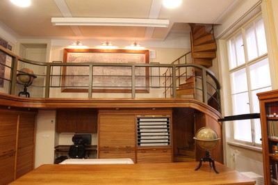
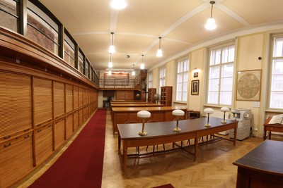
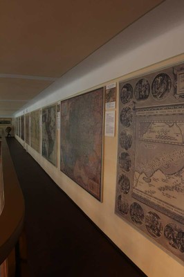
The Kuchař Gallery of Cartography presents key works from the collection and also introduces the main European schools of cartography. Visitors will see the oldest maps of the Czech lands by S. Münster, globes from the workshop of Jan Felkl, Hollar’s vistas, maps by J. A. Komenský, P. J. Šafařík, J. B. Homann, H. Hondius, A. Ortelius, G. M. Seutter, P. Mortier, G. Delisle, and G. of Tilbury. Digital presentations offer a cross-section of Map Collection treasures, looks at the oldest digitized globes and a video about the contest for georeferencing old maps.
At the opening of the map collection was made available the gallery cartography bearing the name of an important representative of historical cartography and longtime director of the collection. Gallery maps the basic work of fund collection and also a major cartographic approaches and schools. He was also ready overview of the history of cartography. Some old maps were analyzed using advanced cartometric methods that allow backward to reconstruct their cartographic parameters, for example, used cartographic display. On the panel, visitors can compare the contents of current and historical maps highlighting places geographically.
Professor Karel Kuchař (1906-1975) was a prominent physical geographer and cartographer. From 1924, when he became a university student of geography, until his death in 1975, he was associated with the map Collection. In 1946-1957 he edited the magazine titled Kartografický přehled (Cartographic Overview). He was also known as an author of school geography atlases, reference and wall maps and cartographic textbooks. He was also editor-in-chief of the Československý národní atlas (1966) and an editor of the Československý vojenský atlas. He also substantilly contributed to the unique historical cartographic edition Monumenta cartographica Bohemiae (the edition was initiated by V. Švambera and B. Šalamon). With A. Dvořáčková he provided description to Molla's collection in Brno, collected professional lettering of old maps, atlases and globes. When looking for the oldes maps of our lands Kuchař managed to discover a number of unknown maps, including the oldest map of Moravia. Due to the helpfulness of the professor of physics K. Kuchař Jr. the Map Collection was granted a licence to publish the works of this scientist in digital form. The Gallery therefore pays tribute to this pioneer of the Czech historical cartography.
The exhibition is in Czech and English. Collective groups must book in advance, find out more Here.
 Left gallery (Photo: M. Kowalski)
 Map Collection (Photo: M. Kowalski)
 Kuchar's Gallery of Cartography
(Photo: M. Kowalski)
Document Actions