Geographical institute
Interdisciplinarity
Researchers in the geographical institute study a wide variety of natural and social phenomena and processes along with their mutual interactivity in forming perceived landscapes. The integration and cooperation of physical and social geographers, demographers and geo-information specialists at a common workplace makes possible the interconnection of specialised analyses to create a complex, comprehensive view of significant problems of the modern world. Such problems include climatic changes and their effects (e.g. flooding), economic globalization and the impact of foreign investment on the development of cities and regions, or international migration and the ageing of the population.
Dynamic development
The geographical institute has undergone significant growth since the beginning of the 1990s. In 1990, 40 students completed studies in three master degree fields of study and 22 pedagogues oversaw instruction. At present, geography offers ten fields of study at the bachelor level, into which it accepts approximately 200 students each year. In its two-year master degree program, geography provides instruction in nine fields of study. Doctorate studies are organized into six fields of study. More than one thousand students are currently studying in the geographical institute, which is staffed by more than 100 employees, making it one of the largest geographical research institutions in Europe.
High quality conditions for study
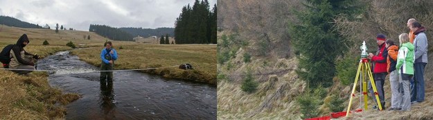
We place emphasis on the quality, currency and comprehensive nature of the subjects we teach and we strive to flexibly adapt to changing professional requirements. An individual approach to students is a given. We offer acceptance without entrance exams to the participants in specialized academic olympiads. Instruction is provided in lecture halls and in geographic information systems, remote sensing, statistical analysis, sediment analysis and dendro-geomorphological dating laboratories, all of which are well-equipped with modern technology. The geography library and map collection provide a broad base of specialized literature and a comfortable studying environment. Domestic and foreign excursions and field exercises are an integral part of study programs. Students can utilize state-of-the-art instruments and software. A wide variety of foreign exchange opportunities supported by the ERASMUS program and other projects enable students to acquire specialized, linguistic and cultural knowledge from other countries. The best students are included in research projects and, thereby, learn to work in teams, present the findings of their work and acquire additional practical skills and practices useful in their own professional career. Students as well as teachers compete in the geographical sports’ day at Charles University’s facilities in Prague Hostivař. The exhibit gallery in the hallway approaching the geography library hosts a number of cultural events and social gatherings during the year.
International cooperation
We support the international mobility of students and teachers and participate in international projects. We partner with significant international institutions in both research and teaching. Students from Dartmouth College in the USA have studied in the Department of Social Geography and Regional Development every spring semester since 1994. Some doctorate dissertations are completed within a so-called co-adviser system (co-tutelle) in cooperation with partners in France. In research regarding the socio-economic aspects of health, we are cooperating with leading experts from the University of California’s School of Public Health. The Department of Demography and Geodemography is part of the international network Population Europe: The European Population Partnership, which includes 17 prestigious European demographic research institutions. ENVISAT, an established satellite data retrieval station and the realization of courses, involving leading European experts from the field of remote sensing, are examples of the increasing cooperation of the Department of Applied Geo-information and Cartography with the European Space Agency (ESA). The geomorphology and geodynamics team from the Department of Physical Geography and Geoecology has been recognized as a World Centre of Excellence for its research into mass movements of soil. This team works with colleagues from Oxford and Cambridge in England, among others, in researching topics concerning natural threats and the effects of climatic changes. We are active in international professional organizations (e.g. the International Geographical Union – IGU, the International Consortium on Landslides – ICL and the International Association of Landscape Ecology – IALE) and participate in the editorial boards of prestigious journals (e.g. Geografiska Analler B: Human Geography, Geomorphology, Health & Place, Landslides and Urban Research and Practice).
Research important for society
In addition to classroom instruction and basic research activities, experts from the geographical institute are actively seeking solutions to current and practical problems. For example, physical geographers are cooperating in the implementation of proper utilization of the natural potential of landscape to minimize the impact and effects of extreme flooding in the system of integrated anti-flooding protection. Research from social geographers on topics of international migration, residential segregation and regional development supports decision making in Ministries for Regional Development, Labour and Social Affairs and the Interior. Demographers contribute with the creation of population prognoses and their impact on pension reform, as well as by analyzing demographic ageing and issues concerning families, seniors and inter-generational solidarity. Geographic information systems are used in the creation of navigation systems, updating map data, evaluating satellite images for crisis management in the event of natural disasters and monitoring long-term climate changes.
Document Actions