100 Years of the Map Collection
An exhibition commemorating the anniversary and re-opening of the Map Collection
A digitized version of the exhibition is available online in the CU digital repository.
As part of the celebration commemorating the opening of the renovated Map Collection on March 21st, 2013, the public was presented with an exhibition titled 100 Years of the Map Collection. The exhibition was organized by the Geography Department of the CU Faculty of Science and was held from March 21st – 31st in the foyer of the Map Collection at Albertov 6.
More about the Grand Re-Opening of the renovated Map Collection Here.
The one-hundred-year-old Map Collection of the CU Faculty of Science is once again open for students and the public as well
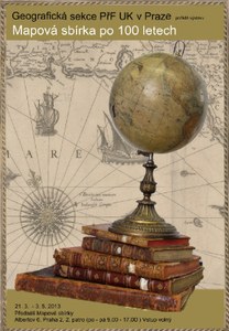 Openning poster of the exhibition
(Source: Map Collection)
The largest university collection of cartographic documents in Central Europe, the Map Collection of the Faculty of Science of Charles University will be re-opened on March 21st, 2013 after two years of renovation. The collection includes 130,000 maps, 2,000 atlases and 80 globes. It contains original works of Komenský or Hollar, rare manuscripts of the 3rd military mapping from the Vienna archive, ethnographic maps by P. J. Šafařík, maps from the estate of J. Barrand and Cell’s inflatable paper globe from 1831. The oldest dated map is a small map of Vienna by A. Hirschvogel from 1547.
The revitalization of the Map Collection endeavored to preserve the unique historic interior while at the same time creating a suitable environment to store, manage, and provide access to special old and valuable prints (up to 1850) and manuscripts. These constitute roughly 50% of the entire collection numbering 130,000 maps, 2,000 atlases and 80 globes. The collection contains original works from important Czech cartographers and artists such as Klaudyán, Criginger, Aretin, Podolský, Komenský, Hollar, Vogt, Müller, Helwig, narrated collector’s atlases, thematic atlases (historical, astronomical, geological, military etc.), and atlases from famed master cartographers and artists such as Mercator, Ortelius, de Jode, Hondius, and Vilém Blaeu. There is also a remarkable collection of 80 globes of various provenance, sizes and materials. Perhaps the most interesting is Cell’s paper globe from 1831, which fits into a small box measuring 9x21x21 cm, but when blown up measured 113 cm in diameter. The oldest dated map is a small map of Vienna by A. Hirschvogel from 1547. Also found here are the hand-drawn ethnographic maps of J. Šafařík, a map of the National Theater and maps from the estate of J. Barrand. "The handwriting on both maps undoubtedly belongs to J. Barrand..., I had no idea these maps existed," said specialist doc. Jaroslav Marek from the UC FS geology department. Also discovered in the collection were rare original manuscripts from the 3rd military mapping at a scale of 1:25,000 from the Vienna archive, which were handed over after the founding of the Czechoslovak Republic to the State Map Collection. “I described attractive maps in the CU Map Collection in the book Alte Landkarten, which was published in six editions, including French,” said leading historical cartographer from Munich Dr. Ivan Kupčík. Due to the effects of improper equipment added to the hall, high temperatures, low humidity and direct sunlight, the collection has gradually been damaged over the years. In 2010 the decision was made to completely renovate the unique historic hall. The main goal was to restore the magnificent hall while retaining all of its functions, protecting the collection, and improving conditions for researchers. “We wanted to rid the hall of unfavorable elements from the past and restore its original form, system and internal purpose. We didn’t want to have a dead and chaotic map storeroom where nobody could find anything and the collection literally suffered, but a living collection which could provide a major resource for science and research,” said Eva Novotná, Director of the Map Collection. The hall was renovated from top to bottom, from the electrical wiring and water lines to the very last screw on the new shelves. The result is a restored historic interior, complete with stylish touches. The historic furniture was refurbished and the internal equipment was restored to meet the demands of document storage. The hall was equipped with the most modern information technology to serve users and collection employees. There is a remote-control data projector with projection screen, a plasma screen, floor boxes with computer network wiring and a WiFi network. Special attention was given to the climate control, lighting and security, ensuring the greatest possible protection for the collection’s valuable items.
Special “smart” windows for example, screen up to 70% of light, while heat, temperature and humidity are controlled by special data loggers. The original Art Nouveau lights were completely restored and their insufficient level of light is supplemented with lamps on research and work tables. Researchers can now use a giant mobile restoration map with special fluorescent bulbs.
Changes in the Map Collection are not only evident in the interior, but also in the improved quality of services. The space and facilities for researchers have been expanded and general technical equipment improved. Thanks to the audio-visual equipment it will be possible to give smaller lectures at the collection. The newly opened Kuchař Gallery of Cartography provides a brief history of the field and will be open to the public and school field trips. Researchers welcome new opportunities for accessing documents. As part of the TEMAP project, documents are given expert descriptions and unique signatures. Around 50,000 documents are already accessible from the CU Central Catalog and the Union Catalog of the CR. Around 48,000 maps are available to researchers 24 hours a day in the Digital University Repository. Images can easily be zoomed. Presently, 67 publisher and 24 collector’s atlases have already been digitized. “Cataloging and digitizing will enable us to provide quality access while protecting the collection. Researchers can comfortably work with our documents from their studies, while the items remain stored in a stable environment without being exposed to risk factors,” explained Eva Novotná, Director of the CU FS Map Collection.
The project is also preparing additional cartometric extensions for Czech map collections. Software has been readied to detect unknown cartographic images, a special catalog to browse maps is being created, and in the Moravian Regional Library the Georeferencer tool has been created to locate places on old maps. This can be used in part thanks to the coordinates recorded directly in bibliographic records. On the same day the Map Collection is accessed, a website at www.staremapy.cz will be launched, enabling cooperative georeferencing of digitized Czech map collections, open to the public. Such data will enable browsing of map collections using geographic searches or allow more complicated cartometric analysis. “For a long time we didn’t understand the point of recording coordinates in bibliographic records. The Georeferencer has made that completely clear. I’m sure that our students will also enjoy it,” added Eva Novotná. The Map Collection was established along with the CU Geographic Institute in 1891. In 1913 it was moved to Albertov 6, Prague 2, to an original historic interior inspired by the French National Library. When the Faculty of Science was founded in 1920, the collection became the State Map Collection of the Czechoslovak Republic, as proposed by Prof. V. Švambera. In 1953 the State Map Collection was disbanded and incorporated into the Czechoslovak Academy of Science as the Department of Cartography of the Geographic Institute. This in turn was dissolved in 1993 and the Map Collection returned to its original owner, the CU Faculty of Science. Director of the Historic Institute of the Czech Academy of Science Prof. Eva Semotanová said of the collection: “The uniqueness of the Map Collection lies in the long tradition of history of cartography at Charles University in conjunction with the founding of the collection, the uniqueness of maps and atlases stored there, and the incredible space housing the collection which has been preserved to the present and meticulously restored.”
The exhibition 100 Years of the Map Collection can be borrowed from the CU FS Geography Library from Blanka Šimánová (e-mail: simanovb@natur.cuni.cz, tel.: +420 221 951 359).
The exhibition was lent to institutions:
- Jihočes.věd.knihovna České Budějovice (24. 3. - 10. 5. 2014)
- Moravské kartografické centrum Velké Opatovice (15. 5. - 15. 11. 2014)
- Salon Královehradecký Hradec Králové (1. 9. - 15. 10. 2015)
Document Actions