New SW for work with old maps
After a two year development the new software "detectproj" for the projection analysis has been released by Ing. Tomáš Bayer, PhD. from Department of Applied Geoinformatics and Cartography
It is an analytic tool designed for cartographers as well as for enthusiasts combining the robust numeric procedures with the ease of use of a graphical interface. Currently, more than 100 map projections are supported. It allows you to recognize the projection name and family, estimation of the normal/transverse/oblique aspect of the projection, true parallel latitude as well as the central parallel shift. In addition, the map scale and rotation can be determined.
The graphical interface with two map windows side by side (Open Street map client as the reference map) together with the fast detection in the separated thread, and the drag and drop operations support make detectproj easy-to-use. For the candidate projections (sorted by the residuals) the meridians and parallels may be reconstructed.
Sample of the analysis on map by A. Ortelius from 1587:
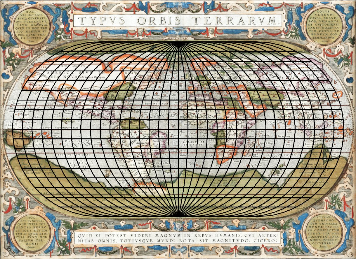 Projection: Ortelius
Map: Typus orbis terrarum. Ab. Ortelius describ. cum privilegio decennali 1587
Detectproj is released under GNU/GPL license, runs on Linux/Unix, Windows, and Mac OS X, and it is available free of charge.
https://web.natur.cuni.cz/~bayertom/index.php/projection-analysis/installation
contact: Ing. Tomáš Bayer <bayertom@natur.cuni.cz>
Published:
Mar 06, 2017 10:20 AM
Document Actions