Exhibition: Map of the Kingdom of Bohemia, 1720
This exhibition was interrupted in 2020 by government measures, due to the epidemic of COVID-19. That is why we are re-exhibiting it here.
| When |
Jan 17, 2023 08:00 AM
to
May 23, 2023 06:00 PM |
|---|---|
| Attendees |
Pro širokou veřejnost |
| Add event to calendar |
|
You can find the exhibition in the building of the Faculty of Natural Sciences of Charles University, Albertov 6, Prague 2, on the second floor.
Geographical Section of the Faculty of Natural Sciences of Charles University, Map Collection and Geography Library are organizing the exhibition Map of the Kingdom of Bohemia, 1720.
The exhibition presents the life and work of the Austrian military engineer and cartographer Johann Christoph Müller (1673–1721), whose so-called large map of Bohemia under the title Mappa geographica Regni Bohemiae was published 300 years ago. Mapping took place gradually. Müller first targeted and drew Hungary, then Moravia, and in 1712 he started with a large map of the Czech Kingdom. He completed field work in 1718. He laid out the map on a scale of 1:132,000 into 25 sections. The 48 map markers in the legend indicate not only towns, villages and monasteries, but also mines, glassworks or, for example, mills. He also recorded mountain ranges, watercourses and ponds. Changes in the land system were reflected on the map, when in 1714 the country was divided into 12 regions. After the completion of Müller's work in 1720, the Czech estates commissioned Augsburg master Michael Kauffer to engrave the map on copper plates. The corner illustrations of the map were originally designed by the well-known baroque painter Václav Vavřinec Reiner. Unfortunately, the author did not live to see the publication of the work in 1722. 48-year-old J. Ch. Müller died a year earlier of work exhaustion. His work was continued by Lieutenant Johann Wolfgang Wieland, who completed revisions of the printing plates of the large map. He then reduced the work to the form of a so-called medium map on a scale of 1:231,000. The copper matrices of the map of Bohemia have been preserved to this day in the National Technical Museum in Prague. In 1934, reprints were even printed from them for the edition of old maps published by the then Institute of Geography of Charles University under the title Monumenta cartographica Bohemiae. The edition was led by university professors Václav Švambera and Bedřich Šalamon. Visitors can see the reconstruction of the monumental new print in the side corridor on the 2nd floor, where this large map is installed. In addition to the large and medium maps, the exhibitin also presents a map of Chebsk and its manuscript from 1714. Maps of Moravia and Hungary are also on display. Müller's big map was secret. The emperor gave his approval for free sale, but it was used until the Napoleonic wars.
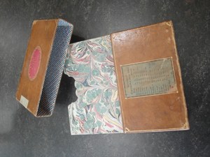 Cover for Müller maps
Visitors to the exhibition can view copies of Müller's maps from the Map Collection of the Faculty of Science, Charles Univerzity, as well as examples of printing plates from the National Technical Museum. A copy of the manuscript index to Wieland's Central Map of Bohemia was kindly provided by the Central Archives of Land Surveying and Cadastre.
Author of the exhibition: PhDr. Eva Novotná, Ph.D.
novotn48@natu.cuni.cz
221 951 355
Published:
Jan 16, 2023 12:00 PM
Document Actions