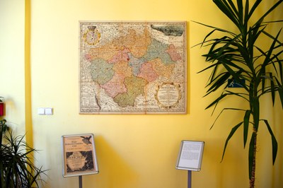
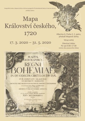
Renovation of the large Müller map of the Kingdom of Bohemia completed
It took almost a year to renovate a large map of the Kingdom of Bohemia by Johann Christoph Müller at the Faculty of Science, Charles University at Albertov. The map has become an essential part of the local interior. Now, you can see the map, as well as the exhibition and the video.
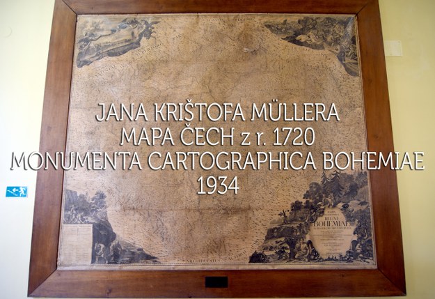
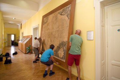
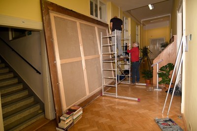
Müller's large map of Bohemia has been installed here since 1934 as a copy taken from the edition of old cartographic heritage Monumenta cartographica Bohemiae, published by the Institute of Geography of CU between the world wars. Ninety years later, the map was quite used and damaged. Therefore, in 2019, it was decided to repair it. The manipulation with the map was not easy, because the internal dimensions of the it were 250 cm x 280 cm and the frame was made of oak planks with a width of 23 cm.
The "new" map was created from new prints made in 1934 from the original copper plates, which are preserved in the National Technical Museum. The restorer Miroslav Široký (together with his wife), cleaned them, glued them to the stretched base canvas and impregnated them. The original damaged map was removed and now is stored in the Map Collection of FSc UK.
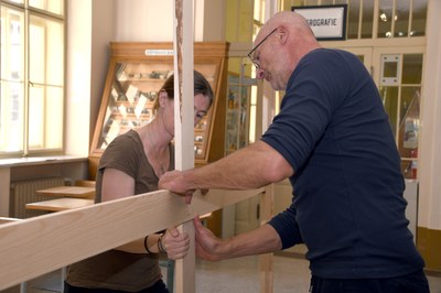
It was also necessary to deal with the original giant frame. It had to be removed, examined and re-measured. It was necessary to make a lower tensioning frame for the new map, but most of today's framers are no longer able to make it. The next step was to place the entire map with the lower frame into the original cleaned frame. This step was entrusted to the gallery owner Mr. Jaroslav Peck. He had the lower frame professionally made and assembled it with his colleagues. Then he stretched the canvas with the new map on it. He then removed the original damaged map.
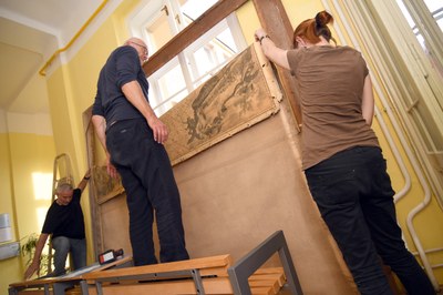
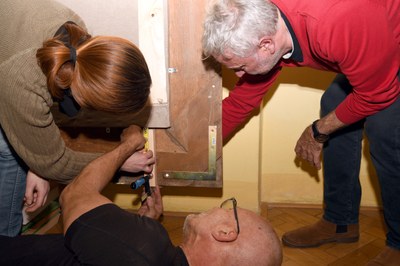
The difficult task was to attach the lower frame to the upper one - that was done by using special steel eyelets.
Then the original frame was cleaned. Petr Javůrek and colleagues from the department of building administration strengthened it in the corners with steel strips. Later, the employees of the Map Collection painted the wood with beeswax.
The weight of the map increased significantly, so new special steel hangers had to be made. In addition, the map was shored-up with special metal supports. Its direct lighting is currently being prepared.
The whole event was initiated by Eva Novotná with a team from the Map Collection of FSc CU. The reconstruction could be organized and completed thanks to the support of the Geographical Section of FSc CU, especially thanks to Vice-Dean Martin Ouředníček.
Most of the work was documented by colleagues Michal Rezek and Tomáš Petrus from the Information Technology Center. In collaboration with Eva Novotná, they created a short film capturing the renovation of this interesting cartographic heritage in Albertov. You can watch the video on YouTube!
Don't miss an interesting cartographic heritage!
Published:
Oct 02, 2020 10:40 AM
Document Actions