Digitized maps in the Kramerius Digital Library
Over 2,600 digitized maps from the Map Collection at the Faculty of Science CU were uploaded to the Kramerius Digital Library at Charles University. Explore them!
The Kramerius Digital Library will prospectively replace the existing Digital University Repository. As of November 11, 2021, there were over 2,600 maps in the new online library, which can be viewed and downloaded in 300 DPI resolution and JPEG2000 format without watermarks. Detailed metadata and bibliographic citations of maps are also available. Cartographic documents can also be printed.
Take a look at some examples that will show you the possibilities of a digitized collection of maps - you can follow the development of cartographic representation of our planet or individual continents, study city plans or just enjoy viewing maps in high resolution.
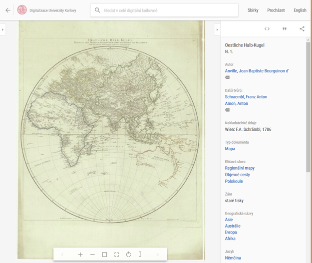 ANVILLE, Jean-Baptiste Bourguinon d', Franz Anton SCHRAEMBL a Anton AMON. Oestliche Halb-Kugel, N. 1. neuvedeno. Wien: F.A. Schrämbl, 1786. 1 mapa : mědiryt, kolor. ; průměr 60 cm na listu 88 x 63 cm, s. 1. Available also from: http://kramerius.cuni.cz/uuid/uuid:99f82536-3bca-11ec-a8bb-fa163e4ea95f
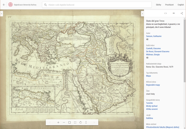 SANSON, Guillaume, Giacomo CANTELLI, Giovanni Giacomo DE ROSSI a Giorgio WIDMAN. Stato del gran Tvrco: diuiso ne suoi beglierbati, ò gouerni, e ne principati, che li sono tributari. [ca 1:10 000 000]. 10,4 cm = 600 miglia d'Italia = 250 leghe di Francia = 200 leghe d'un' hora di camino. Roma: Gio. Giacomo Rossi, 1679. 1 mapa : mědiryt, kolor., podlepena papírem ; 41 x 55,5 cm na listu 58 x 68 cm, s. 1. Available also from: http://kramerius.cuni.cz/uuid/uuid:7eb2b3c6-3e37-11ec-a6d5-fa163e4ea95f
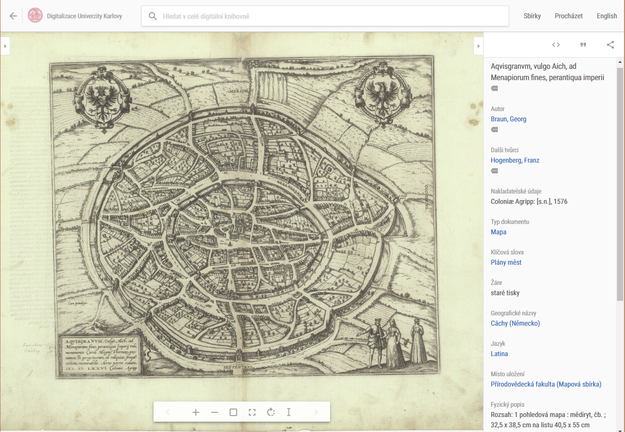 RAUN, Georg a Franz HOGENBERG. Aqvisgranvm, vulgo Aich, ad Menapiorum fines, perantiqua imperii vrbs, monumento Caroli Magni, thermar[um] prestantia, & peregrinorum, ob reliquias, freque[n]tatione, memorabilis. neuvedeno. Coloniæ Agripp: [s.n.], 1576. 1 pohledová mapa : mědiryt, čb. ; 32,5 x 38,5 cm na listu 40,5 x 55 cm, s. 1. Available also from: http://kramerius.cuni.cz/uuid/uuid:a7f3bf7a-422c-11ec-9cce-fa163e4ea95f
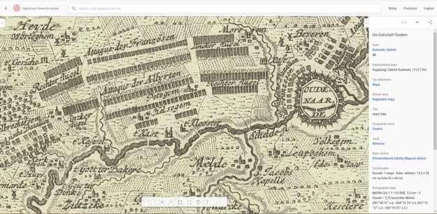 BODENEHR, Gabriel. Die Grafschaft Flandern. [ca 1:1 110 000]. 2,5 cm = 5 Stunde = 3,75 teutschen Meilen. Augsburg]: Gabriel Bodenehr, 1713-1765. 1 mapa : kolor. mědiryt ; 15,5 x 20 cm na listu 56 x 64 cm, s. 1. Available also from: http://kramerius.cuni.cz/uuid/uuid:94ecf898-3d80-11ec-b970-fa163e4ea95f
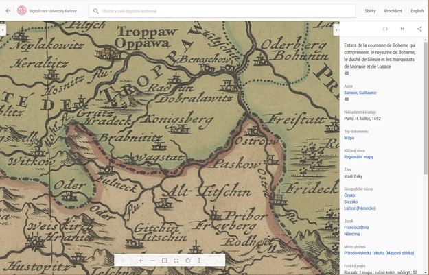 SANSON, Guillaume. Estats de la couronne de Boheme qui comprennent le royaume de Boheme, le duché de Silesie et les marquisats de Moravie et de Lusace. [ca 1:900 000]. 8,2 cm =40 Mille Pas Geometriques ou Milles d' Italia = 16 Lieues Communes de France = 13,5 Grandes Lieues de France = 10 Lieues Communes d' Allemagne = Grandes Lieues d' Allemagne = Lieues d' une heure de Chemin. Paris: H. Iaillot, 1692. 1 mapa : ručně kolor. mědiryt ; 52 x 86 cm na listu 63,8 x 97,5 cm, s. 1. Available also from: http://kramerius.cuni.cz/uuid/uuid:770e6b68-326d-11ec-9cb3-fa163e4ea95f
Published:
Nov 12, 2021 12:00 AM
Document Actions